
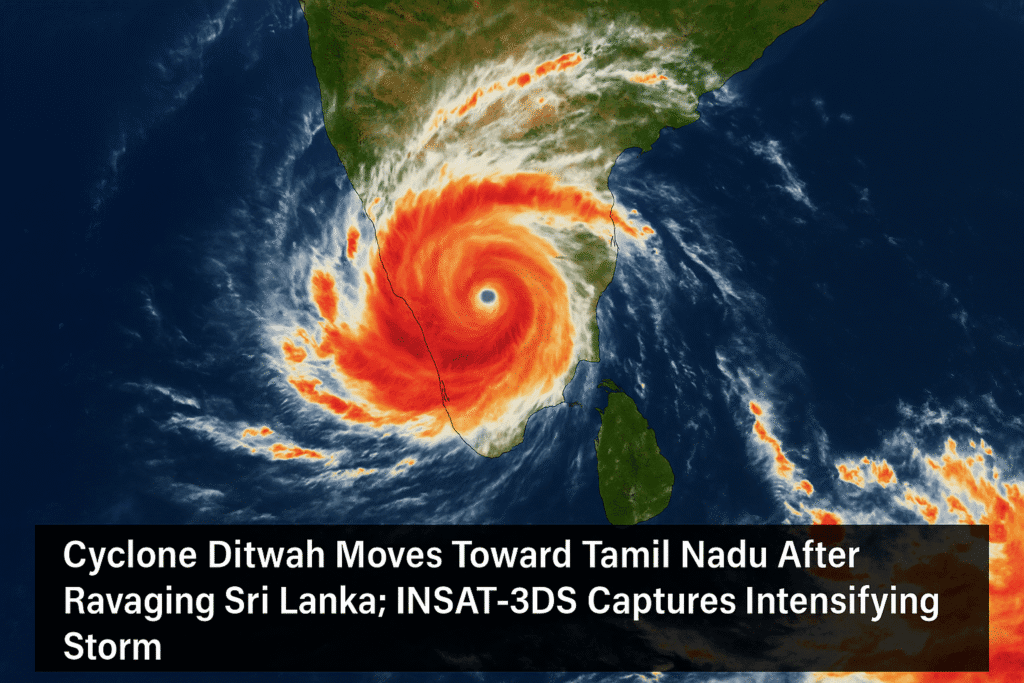
India is on high alert as Cyclone Ditwah, which caused severe damage across Sri Lanka, continues to intensify while moving northwest toward the Tamil Nadu coast. Newly released satellite images from ISRO’s advanced INSAT-3DS meteorological satellite reveal the storm’s well-defined core and expanding rain bands, supporting real-time forecasting and disaster planning.
The cyclone made landfall in Sri Lanka on Friday, November 28, unleashing torrential rainfall, floods, and landslides that left 56 people dead and 23 missing. Trains were suspended, schools closed, and essential services crippled in multiple districts.
According to the India Meteorological Department (IMD), Cyclone Ditwah is currently tracking north-northwest at 6 km/h with sustained winds of 65 km/h, while core wind speeds near landfall may reach 60–80 km/h, gusting up to 90 km/h. Outer bands are expected to bring 35–55 km/h winds over Tamil Nadu, Kerala, Lakshadweep, and the Maldives.
High Alert Across Tamil Nadu
Tamil Nadu authorities have placed multiple districts under red and orange weather alerts.
- Red Alert: Cauvery Delta districts
- Orange Alert: Chennai, Tiruvallur, Kancheepuram, Chengalpattu, Ranipet
The National Disaster Response Force (NDRF) has deployed 30 personnel along with a dog squad for swift rescue operations. Officials have also reviewed the state’s automated weather stations, TN Alert app, and TN Smart 2.0 portal for coordinated disaster management.
Marine Warnings Issued
Fishermen have been strongly advised not to venture into the sea for five days, with the Bay of Bengal witnessing extremely rough conditions and wave heights expected to rise to 4.9 meters.
Cyclone Path & Forecast
INSAT-3DS data shows the cyclone following a poleward trajectory influenced by subtropical ridges. It may weaken slightly over land but could re-intensify once it moves back over open waters. Current models indicate that the system is likely to travel parallel to the Tamil Nadu coastline, bringing widespread rainfall to coastal districts and the Cauvery Delta region.
District collectors have been instructed to maintain full vigilance, initiate evacuation where required, and ensure immediate relief measures.
Originally published on 24×7-news.com.


4 Responses
Parimatch, eh? India login specifically? Alright, gave it a whirl. Seems legit, quick setup process. If you’re looking for a hassle-free way to get in the game, give it a go: parimatchindialogin.
Vtbet, not bad! A friend told me he had a good run there. Of course, your mileage may vary, but it’s worth a look! See if they got what you’re looking for by clicking here: vtbet
‘yy567game’ is where I find some of the best quick games! Lots of different styles and opportunities!. Check it out for some non-stop action here: yy567game. Get gaming!
Checked out indiatez888 for some local betting options. Not bad, pretty standard stuff. If you’re looking for a quick bet this might be it.